The Tyne and Wear Metro was designed to do more than restore rail services. It joined former suburban lines to new tunnels beneath Newcastle and Gateshead, creating a rapid transit network for a region whose local transport system had been judged inadequate. The first trains ran in 1980; the original network was completed in 1984. Since then, extensions, new trains and upgrades have carried the system into a new era while preserving its defining role: linking communities across the North East.
Building a new network from an old one
The Metro’s roots lie in the earlier railway network. Much of the infrastructure it uses today was built between 1834 and 1882. In the early twentieth century, the North Eastern Railway electrified parts of the local network north of the Tyne, creating the Tyneside Electrics. Lines south of the river were also electrified. British Rail later converted these routes to diesel operation, a change widely regarded as a backward step because the replacement trains were slower.
In 1971, the newly created Tyneside Passenger Transport Executive commissioned a study into improving local transport. Its proposal was to revive the run-down Tyneside Electrics routes as an electrified rapid transit system, and to build underground sections through Newcastle and Gateshead where the existing railways did not serve central areas adequately. The wider plan envisaged buses feeding passengers into the Metro, with shared ticketing and purpose-built interchanges. The Tyneside Metropolitan Railway Act received Royal Assent in July 1973, and construction began in October 1974. The organisation now known as Nexus owns and operates the network.
Rather than simply reuse the existing railway, the project connected it with new infrastructure. About 42 kilometres of railway lines were converted, and approximately 10 kilometres of new route were built. This included tunnels beneath central Newcastle and Gateshead, new stations and bridges. The Queen Elizabeth II Bridge carries the Metro across the Tyne; the Byker Viaduct spans the Ouseburn Valley. The completed project cost £265 million, equivalent to £890 million in 2024. It was also the first railway in the United Kingdom to use metric units for speeds and distances.
Opening in stages, then reaching further
The first section opened on 11 August 1980, between Haymarket and Tynemouth. The network grew in stages: services reached South Shields in March 1984, completing the original system. The Metro was intended to sit at the centre of an integrated transport network, with feeder buses and linked timetables. That arrangement did not last beyond the deregulation of bus services in 1986, although passengers can still buy Transfare tickets for journeys involving more than one local transport mode.
Two later extensions brought the network to new destinations. In November 1991, the line reached Newcastle Airport, with stations at Callerton Parkway and the airport. In March 2002, a £100 million extension through Sunderland to South Hylton opened. Part of the route uses the Durham Coast Line, shared with heavy rail services; this made it the first system in the United Kingdom to adopt a form of the Karlsruhe model for shared light- and heavy-rail operation.
The network now has two lines and 60 stations across Newcastle upon Tyne, Gateshead, North Tyneside, South Tyneside and Sunderland. Its 77.5 kilometres of track combine former railway routes with underground and purpose-built sections. Stations vary accordingly: some occupy former railway sites, while others were built for the Metro. Several in central Newcastle and Gateshead are underground. At Sunderland, Metro and National Rail trains share platforms, an unusual arrangement in the UK.
Access, service and a changing fleet
Accessibility was part of the network’s design from the outset. The Metro was the first transport system in the United Kingdom designed to be fully accessible to passengers with disabilities, with step-free access at every station. Later work has continued to address passengers’ needs: a refurbishment programme for the original Metrocars included improved disabled access, and tactile paving was installed at all stations by 2022.
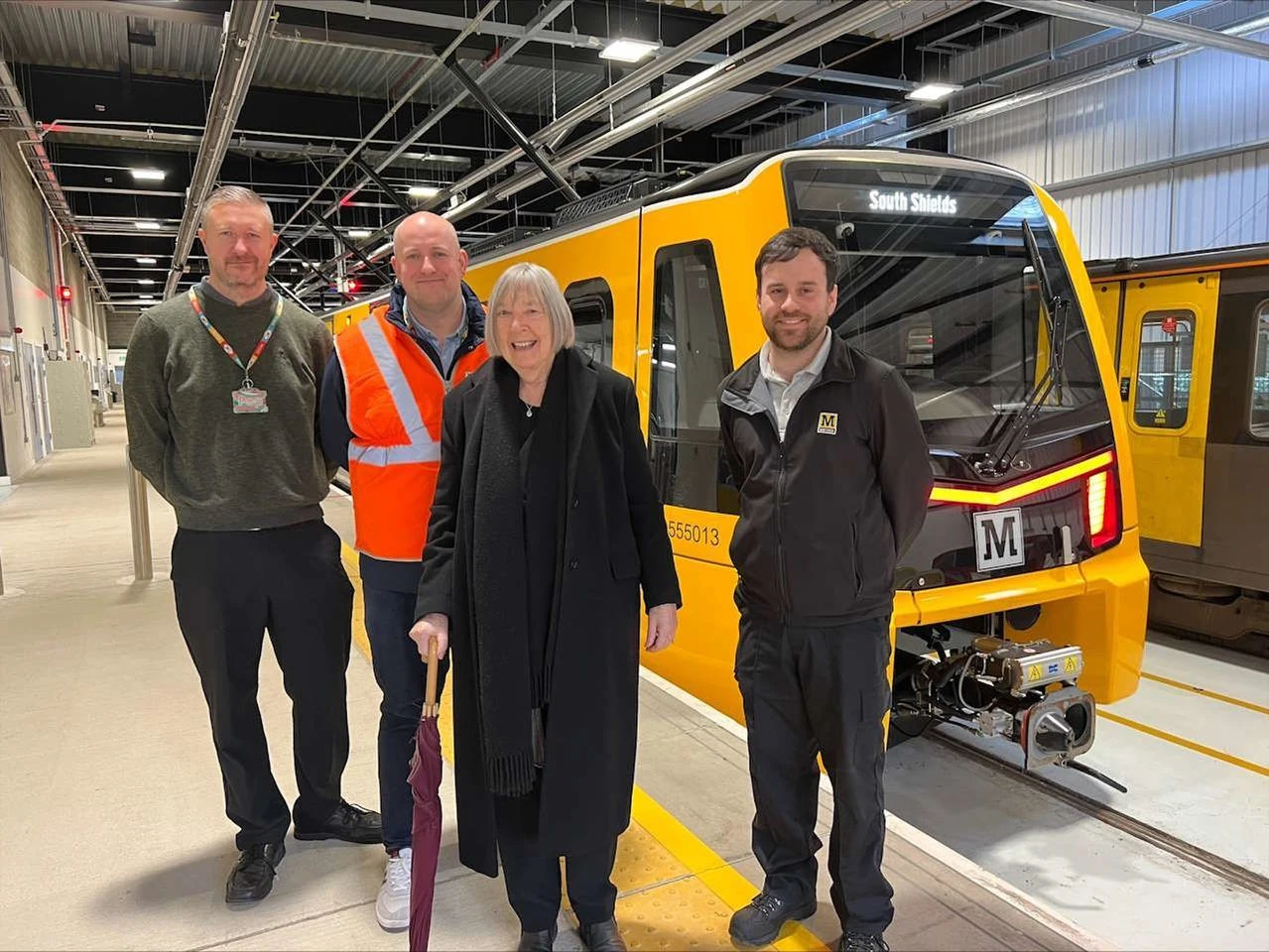
The Metro’s first trains were Metrocars, articulated vehicles built by Metro-Cammell at Washwood Heath. They entered service with the system in 1980 and remained its regular passenger fleet for decades. A major refurbishment of 86 vehicles began in 2010 and was completed in 2015. In 2016, Nexus began plans to replace the ageing fleet. Stadler was contracted to build the new trains, which have wider doors and aisles, air conditioning, Wi-Fi, charging points and audio-visual next-stop information. The first new train entered passenger service on 18 December 2024. The original Metrocars ceased routine service on 26 June 2026, although they may still be used occasionally.
Renewal has also involved the tracks and service pattern. The £103 million Metro Flow project is intended to increase frequency from five to six trains an hour, shorten journey times and improve reliability. Its works include converting three single-track sections between Pelaw and Bede to dual use and electrifying a freight-only line. The increased daytime frequency is planned for December 2026. A separate proposal would extend the network to Washington using part of the former Leamside line. The business case remains under development; the proposed route would connect Pelaw and South Hylton, with stations planned for Washington and Follingsby.
A recognisable part of the region
The Metro’s identity is more than its yellow trains. Designer Margaret Calvert created the typeface first used across the system, including on its signs and maps. The black M on a yellow background became a familiar marker at station entrances. A later rebranding, begun in 2009, renewed the use of the Calvert typeface and a black, white, grey and yellow palette.
Artworks across the network give individual stations a distinct character. There are more than 30 permanent works in the wider transport network, including Vince Rea’s Jarrow March at Jarrow, Nayan Kulkarni’s Nocturne on the Queen Elizabeth II Bridge and Michael Pinsky’s Pontis at Wallsend. This combination of transport infrastructure, design and public art makes the Metro visible in everyday regional life as well as useful for travelling through it.
Why the Tyne and Wear Metro deserves a place in British Legacy
The Tyne and Wear Metro deserves a place in British Legacy because it is a significant British public work whose achievement is both practical and architectural. Its builders did not treat the region’s old railways as redundant or rely on them unchanged. They connected former routes with new tunnels, stations and bridges, creating a rapid transit system that brought Newcastle’s centre into closer reach of communities on both sides of the Tyne and further south towards Sunderland. The project also established a lasting example of how existing railway infrastructure can form the basis of a new kind of urban and regional transport.
Its importance is reflected in decisions made over several decades: designing the original network for step-free access at every station, extending it to the airport and Wearside, and replacing its first fleet with trains offering wider doors, clearer passenger information and modern facilities. The Metro also has a recognisable visual language, shaped by Margaret Calvert’s typeface, the yellow-and-black station signs and artworks installed across the network. These features give the system a strong place in the identity of Tyne and Wear without obscuring its central public purpose. Its British legacy lies in that combination: engineering and design put to work connecting people with places across the North East.
Sources
Tyne and Wear Metro — revision 1375190444
Adapted in part from Tyne and Wear Metro by Wikipedia contributors, under CC BY-SA 4.0. Text has been edited and combined with the existing article; this adapted text is shared under the same licence. Contributor history.